Themes
As a communication platform we will cover a wide range of polar research topics. When it comes to the expeditions we embark on ourselves, we focus our activities to the cryosphere: sea ice, snow and land based ice caps.
Sea ice
Our main focus is on sea ice research in the Arctic. In the Northern hemisphere, sea ice extent and thickness has been decreasing significantly over the last decades. Monitoring these changes is critically important.
We need to prepare for an Arctic with less ice and more access to natural resources. Increased accessibility will offer more opportunities for shipping, fisheries, mining and oil and gas exploration. An increase of these activities combined with the disappearing of sea will put more pressure on traditional lifestyles and ecosystems.
Regional focus
Regionally, we are focusing on the so-called ‘Last Ice Area’. This is the only region where sea ice is projected to survive summer melt until 2050 and possibly beyond.
This region in the high Arctic of Canada and Greenland was identified using sea ice models, and it’s expected to be the last stronghold of summer sea ice as the Earth continues to warm due to climate change. In the coming years and decades, it will be essential as an enduring home for wildlife, and therefore for the communities that depend on those species. More info here.
Besides regional impact and relevance, there is also global relevance of diminishing sea ice. Sea ice plays a significant role in the Earth’s climate system influencing atmospheric and oceanic circulations. Visit this NSIDC page for more info here.
Sea ice dynamics
The amount of sea ice covering the polar seas is not only temperature related, i.e. determined by freezing and melting. Distribution and transportation of sea ice is an important factor and is driven by mechanical forces like wind and sea currents. The international Arctic Buoy Programme coordinates scientific observation of ice drift in the Arctic Basin using drifting buoys. These instruments monitor temperature, air pressure, ice motion and other geophysical quantities. Deploying drifting buoys is costly and logistically and technically complex.
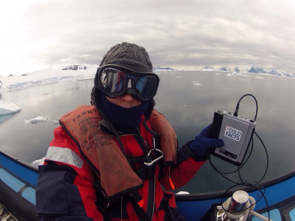
Cold Facts has developed a lightweight, high quality, plug-and-play drifting buoy which can be quickly deployed during ski-expeditions, ice breakers cruises, flight operations and other means of polar travel. The idea is to utilize existing logistical activities to create a better coverage of observations in time and space. In essence, the Cold Facts drifting buoy is a lightweight weather station which movements and meteorological data are tracked and monitored via satellite. Learn more about our instrument.
Sea ice thickness
By means of drill hole measurements and electromagnetic surveys, sea ice thickness is determined. For more details on these procedures please check our technology page.
These measurements are done on a local and in some cases regional scale and provide ground truth validation for airborne or satellite based observations. They are a vital part of the hierarchy of Arctic wide measurements.
Sea ice snow cover
Snow is one of the biggest unknowns when it comes to predicting what is going to happen to Arctic sea ice. As an insulator and sunlight reflecting layer it is a critical interface influencing heat exchange between the ocean, ice and the atmosphere.
Quantifying snow cover and snow load on sea ice is also important to be able to further precise airborne and satellite observations of sea ice such as ESA’s CryoSat2 mission:
Validating satellite observations
ESA's CryoSat2 mission is dedicated to precise monitoring of marine ice in the polar oceans and variations of ice sheets covering Greenland and Antarctica. CryoSat2 is the ideal ice observer. It carries an all-weather microwave radar instrument that picks up the echoes of brief radar pulses bounced off the surface of the ice.
Given that the aim of the CryoSat2 mission is to measure global changes in ice thickness down to a few centimetres per year, it is hardly surprising that a lot of effort goes into ensuring the data are as accurate as possible and that all possible errors are accounted for.
There are a number of possible sources of error which have to be accounted for when interpreting the returning radar signal. For example one needs to know how snow layer properties impact the bouncing radar signal. This is varying by snow wetness, thickness and density. Sea ice thickness is measured indirectly by determining how far floating sea ice is sticking out above the water line. This so-called ‘free-board’ varies depending on how much weight the snow layer imposes.
To understand and correct for such natural sources, validation experiments in the field are necessary. Large-scale, dedicated scientific expeditions have been and will be undertaken. In addition polar explorers can make their contribution by measuring snow thickness during their ski treks. For this purpose a practical snow thickness protocol was developed in 2004 and 2005 together with sea ice specialist Christian Haas. The protocol was later adapted by polar explorers like Børge Ousland (Norway), Pen Hadow (United Kingdom) and Alain Hubert (Belgium).
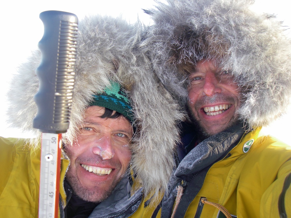
Alain Hubert (left) and Dixie Dansercour during their Arctic Arc expedition in 2007. The duo compiled an incredible data set of snow thickness during their crossing from Russia to Greenland via the North Pole.
Download more information about ESA's CryoSat2 mission here.
Ice caps
We are working on developing activities and technologies to support research on land based ice caps. These ice caps contain enormous quantities of frozen water and their melting, unlike the melting of sea ice, contributes to sea level rise.
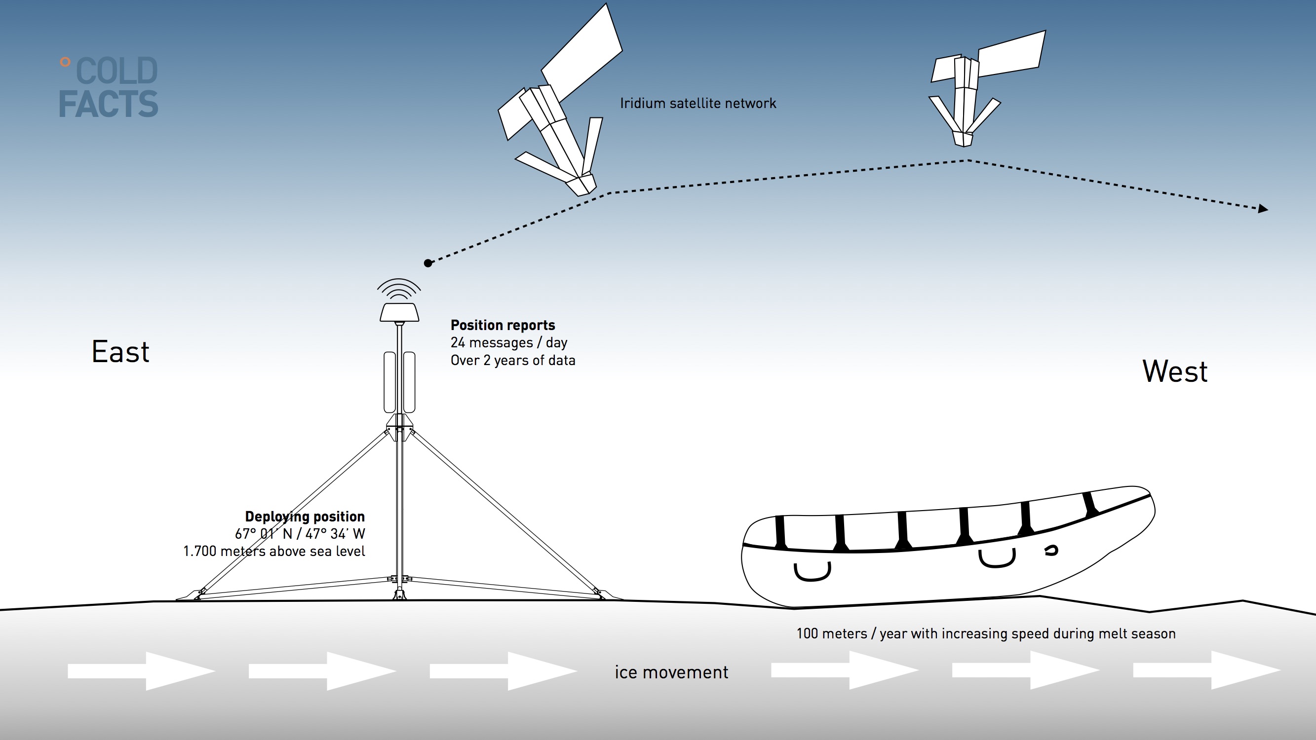
Ice stream velocity
To be able to monitor ice stream velocity near the coast we have developed the ‘Polar Ice Drifter’. With hourly position updates we can monitor ice streams near the edge of for example the Greenland ice cap.
We have assessed a possible deployment in the so called K-Transect, a region in West Greenland which has been studied for decades by the University of Utrecht. Ski-expeditions that cross the ice cap from West to East can potentially deploy the unit at 1.700 meters above sea level. It would fit in nicely with other observations.
Oceans
With scientist Elizabeth Jones in our team we have the possibility to share more about the perhaps not so well known CO2 problem. Emission of CO2 doesn’t only lead to higher atmospheric concentrations and warming air temperatures. Oceans absorb more heat and CO2 and turn more acid.
We will follow Elizabeth (aka Libby) Jones on her field missions and she will comment on important papers and news regarding the role that oceans play in the carbon cycle.